
Features
Regularly updated, full-color maps
53% larger map with a bigger type size than the Rand McNally Folded Map
Clearly labeled Interstate, U.S., state, and county highways
Indications of county boundaries, schools, shopping malls, parks, golf courses, hospitals, airports, and points of interest
Mileage and driving times map
Detailed index
Copyright 2021
Coverage Area Detailed maps of: Burlington, VT; Concord, NH; Manchester, NH; Montpelier/Barre, VT; Nashua, NH; Portsmouth, NH; Rochester, NH
Discover More Best Sellers in Maps
Shop Maps
Rand McNally 2024 Road Atlas & National Park Guide (Rand McNally Road Atlas & National Park Guide)

 Maps - Rand McNally 2024 Road Atlas & National Park Guide (Rand McNally Road Atlas & National Park Guide)
 Maps - National Geographic World Wall Map - Executive - Laminated (46 x 30.5 in) (National Geographic Reference Map)

Pacon PAC78760 United States Giant Map, 48" Width, 72" Length, Black/White
Maps - Pacon PAC78760 United States Giant Map, 48" Width, 72" Length, Black/White

48x70 Wisconsin State Official Executive Laminated Wall Map
 Maps - 48x70 Wisconsin State Official Executive Laminated Wall Map

Gifts Delight Laminated 27x24 Poster: Road Map - Highway Map of West Virginia Virginia Map
Maps - Gifts Delight Laminated 27x24 Poster: Road Map - Highway Map of West Virginia Virginia Map

Cool Owl Maps Texas State Wall Map Poster Rolled (Paper 24"x25")
Maps - Cool Owl Maps Texas State Wall Map Poster Rolled (Paper 24"x25")
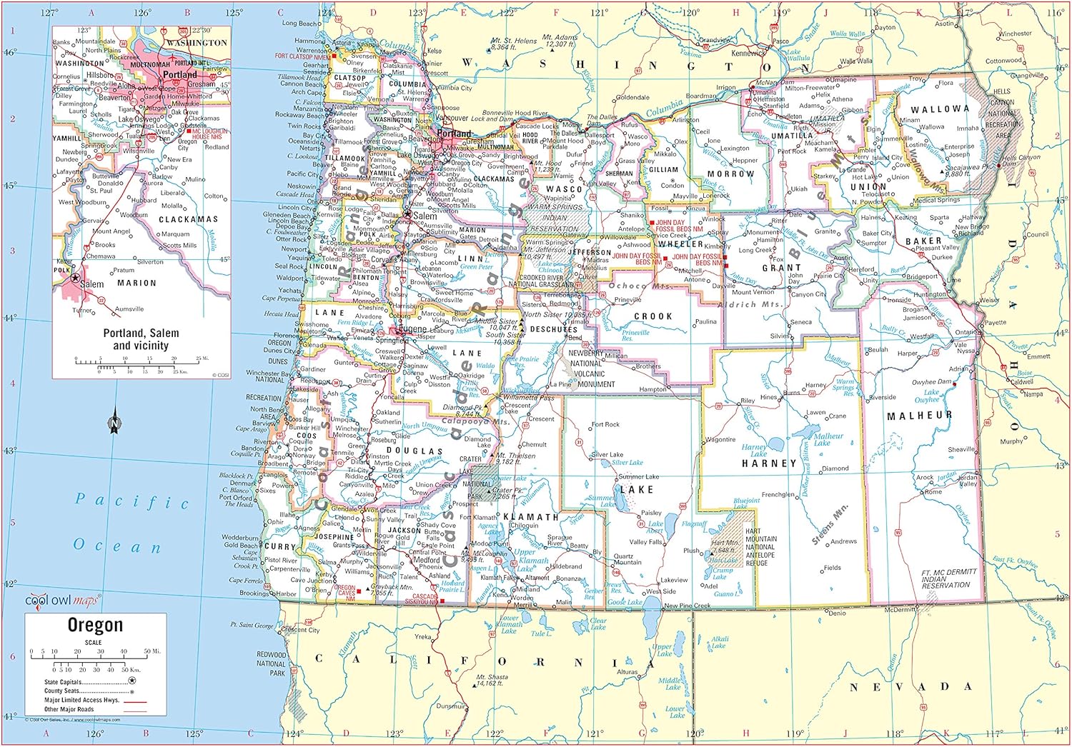
Cool Owl Maps Oregon State Wall Map Poster Rolled (Paper 34"x24")
Maps - Cool Owl Maps Oregon State Wall Map Poster Rolled (Paper 34"x24")
 Maps - Scratch Off Map of The United States | Deluxe Watercolor Wanderlust Edition | Large Size 24"x 17" | Easy to Frame | Beautiful Wall Art | Perfect Travel Gift | Includes Scratch Off Tools


