

Features
17 x 22 inches. Printed on paper. Flat map, tubed for shipping. This beautiful map shows physical and political features for the Philippines and surrounding areas. Relief shading and the use of different colors by height above sea level are both informative and attractive. Scale 1:4,000,000
Details
Looking for a stunning wall map to adorn your home or office? Look no further than our Philippines - 17" x 22" Paper Wall Map. Measuring a convenient 17 x 22 inches, this map is printed on high-quality paper, ensuring that it lasts for years to come. With its detailed representation of physical and political features of the Philippines and its surrounding areas, this map is not only informative but also a beautiful piece of art that will capture anyone's attention.
What sets this map apart from others is its use of relief shading and different colors to indicate the height above sea level. This feature allows you to visually explore the diverse landscapes of the Philippines, from its majestic mountains to its serene coastal areas. Whether you're a geography enthusiast, a history buff, or simply someone who appreciates the aesthetics of a well-designed map, this Philippines wall map is sure to impress.
Not only is this map visually appealing, but it is also highly functional. With a scale of 1:4,000,000, you can expect accurate and detailed information about the geography of the Philippines. Whether you're planning a trip, conducting research, or simply wanting to understand the country better, this map provides all the necessary insights you need. Its convenient size also makes it easy to transport and display, so you can take it on your travels or proudly showcase it on your wall.
Don't miss out on this must-have map for any map lover or Philippines enthusiast. Order your Philippines - 17" x 22" Paper Wall Map today and embark on a visual journey through the beauty of this captivating country. Click here to order now!
Discover More Best Sellers in Maps
Shop Maps


Easy To Read: Florida State Map (Rand Mcnally Easy to Read!)
 Maps - Easy To Read: Florida State Map (Rand Mcnally Easy to Read!)


Antiguos Maps World Ocean Floor Map - measures 24 inches x 42 inches (610 mm x 1067 mm)
Maps - Antiguos Maps World Ocean Floor Map - measures 24 inches x 42 inches (610 mm x 1067 mm)
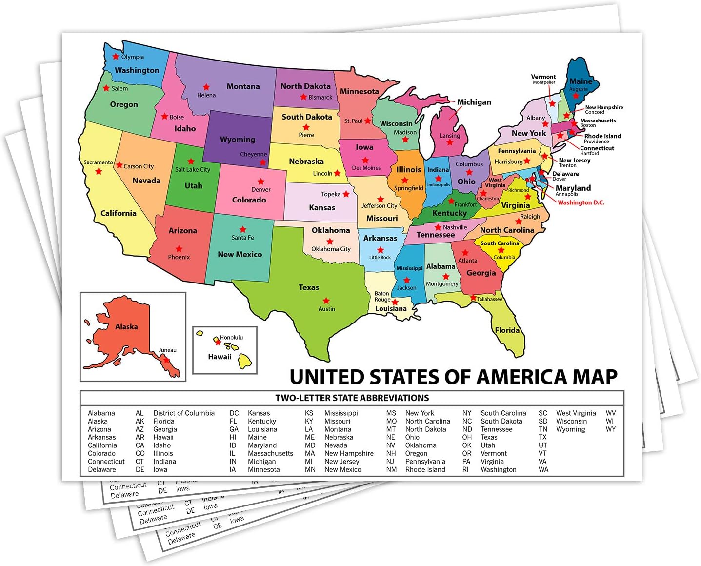 Maps - United States Map - USA Poster, US Educational Map - With State Capital - for Ages Kids to Adults- Home School Office - Printed on 12pt. Glossy Card Stock | Bulk Pack of 10 | 8.5 x 11 Inches

National Geographic: Peoples of Africa 1971 - Historic Wall Map Series - 24.5 x 22.5 - Paper Rolled
Maps - National Geographic: Peoples of Africa 1971 - Historic Wall Map Series - 24.5 x 22.5 - Paper Rolled
 Maps - USA Push Pin Map 24" x 17" - Travel Poster to Mark Your Adventures Around The USA - Travel Camping Gift - USA Poster - Travel Decor

Oregon State Poster Map - 24 x 17 inches – Paper Laminated
 Maps - Oregon State Poster Map - 24 x 17 inches – Paper Laminated

