
National Geographic: North American Indian Cultures Wall Map - 23.25 x 35.75 inches - Laminated

$39.99
Features
Details
Introduce your students to the fascinating world of North American Indian cultures with the National Geographic: North American Indian Cultures Wall Map. Designed specifically for classrooms, this map is the perfect tool to build cultural awareness and help students understand the richness of pre-colonial Indigenous culture. As an added benefit, this map is a unique National Geographic product that offers a comprehensive view of the peoples of pre-colonial North America.
With its laminated finish, this map provides both durability and functionality. You can easily highlight areas of interest on the map using dry erase markers and wipe them off when you're done. No more worries about tears, folds, or spills ruining your valuable educational resource. The glossy laminate finish ensures that this map will last for years of classroom use.
When it comes to cartography, National Geographic sets the standard. You can trust that this map, like all National Geographic products, delivers the highest quality content and display in the industry. With iconic cartography, your students will be immersed in the world of North American Indian cultures as they explore this visually stunning map.
Don't miss out on this opportunity to enhance your students' learning experience. Grab the National Geographic: North American Indian Cultures Wall Map today and discover the wonders of pre-colonial Indigenous culture. Click here to get yours now!
Discover More Best Sellers in Maps
Shop Maps
San Diego & Vicinity Road & Recreation Map, 7th Edition
 Maps - San Diego & Vicinity Road & Recreation Map, 7th Edition


Swiftmaps 32x50 United States Classic Premier Blue Oceans 3D Wall Map Poster (Laminated)
Maps - Swiftmaps 32x50 United States Classic Premier Blue Oceans 3D Wall Map Poster (Laminated)

Marauder's Map Hogwarts Wizarding World Harry Potter Warner Bros LIMITED **NEW**
 Maps - Marauder's Map Hogwarts Wizarding World Harry Potter Warner Bros LIMITED **NEW**
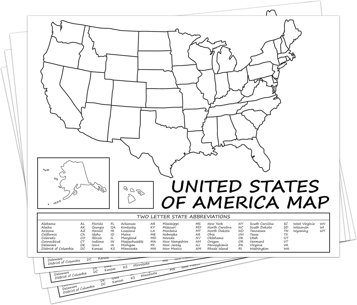 Maps - United States Map - USA Poster, US Educational Map - with 2 Letter State Abbreviation - for Ages Kids to Adults - Home School Office | Printed on 110Lb Card Stock - 8.5 x 11" Inches - Bulk Pack of 10

USA Map for Kids - United States Wall/Desk Map (18" x 26" Laminated)
Maps - USA Map for Kids - United States Wall/Desk Map (18" x 26" Laminated)

XXL USA Map Premium Poster Giant America Map with all States 55" x 39" MAPS IN MINUTESÙ (55"x39")
Maps - XXL USA Map Premium Poster Giant America Map with all States 55" x 39" MAPS IN MINUTESÙ (55"x39")

Philadelphia, Pennsylvania Wall Map, Large - 22.75" x 15.5" Laminated
Maps - Philadelphia, Pennsylvania Wall Map, Large - 22.75" x 15.5" Laminated


