Travelization Scratch Off Map of the USA with National Parks and Highest peaks (XL - 36" x 24", Black)

$30.99
Details
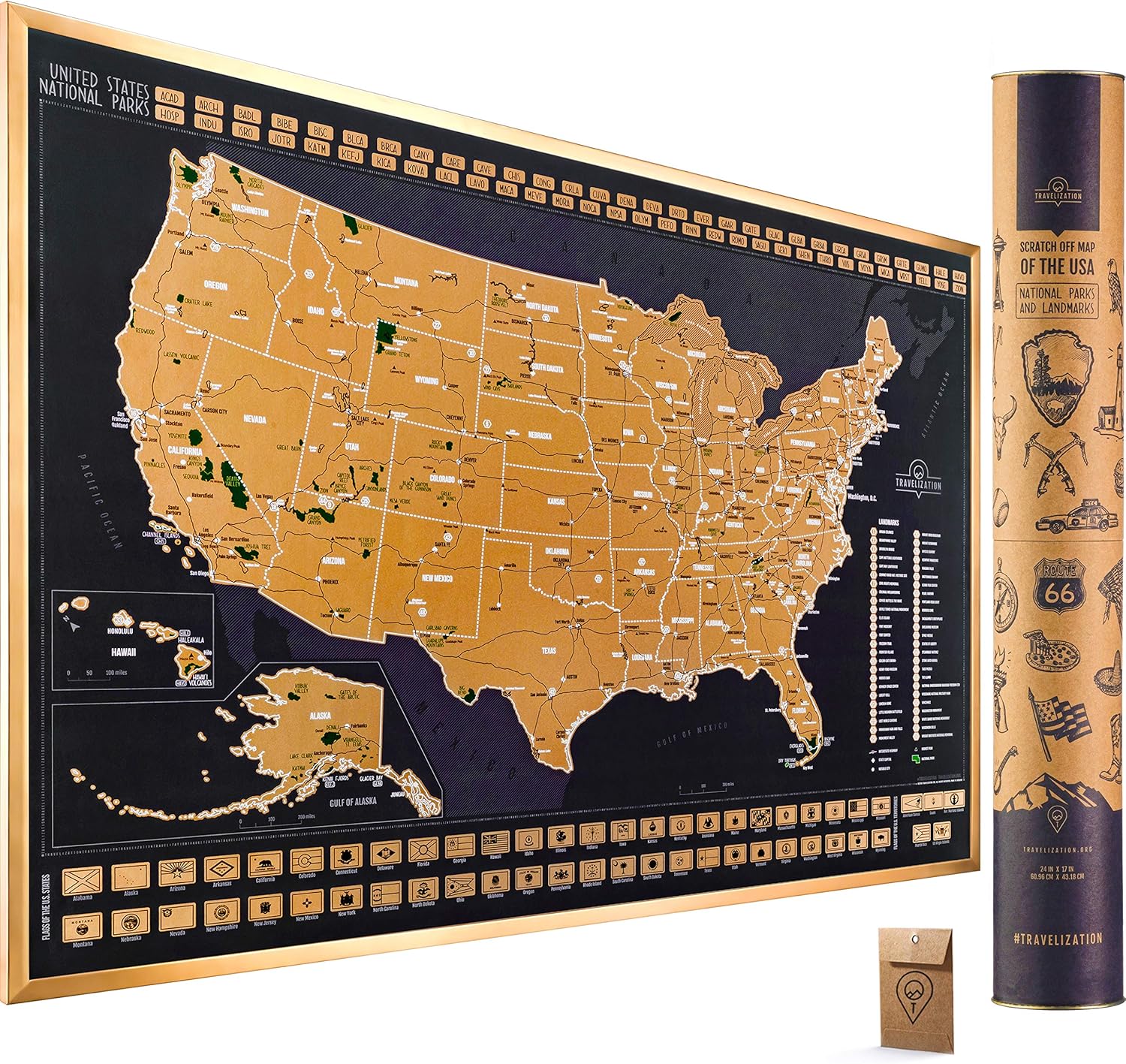
Discover the wonders of America with the Travelization Scratch Off Map of the USA! Unveil the beauty of this great nation as you scratch off each state you've visited, revealing vibrant colors underneath. Whether you're a travel enthusiast or simply looking to explore more of your own backyard, this map is a must-have for every adventurer. With its extra-large size of 36" x 24", it's the perfect centerpiece for your living room or office. Take pride in your travels and inspire your future adventures with this stunning scratch off map!
Designed with meticulous attention to detail, our scratch off map features not only the states but also highlights major national parks and the highest peaks in the USA. Embark on a journey through the spectacular landscapes of Yellowstone, Yosemite, Grand Canyon, and many more iconic parks. Reach new heights as you conquer the country's stunning mountains, from Mount McKinley in Alaska to Mauna Kea in Hawaii. With every scratch, you'll relive the memories of your explorations and dream of your next escapade.
Our scratch off map is not only aesthetically pleasing but also made to the highest quality standards. The sleek black design adds a touch of sophistication to any room while the durable and premium materials ensure long-lasting enjoyment. Whether you want to use it to track your own travels or to give as a gift to a fellow adventurer, this map is truly a treasure to behold.
Are you ready to embark on a journey of discovery? Get your own Travelization Scratch Off Map of the USA with National Parks and Highest peaks today and ignite the spirit of adventure in your life. Start scratching off the states, revealing the vibrant colors beneath and be inspired to explore all the wonders that the United States has to offer. Don't miss out on this opportunity to create lasting memories and showcase your love for travel. Order now1!
Discover More Best Sellers in Maps
Shop Maps
Rand McNally Easy to Read: Connecticut, Rhode Island State Map
 Maps - Rand McNally Easy to Read: Connecticut, Rhode Island State Map

 Maps - State Series Quarters Collector Map: Also Including the District of Columbia and Territorial Quarters

Then and Now Bible Maps: Compare Bible Times with Modern Day
Maps - Then and Now Bible Maps: Compare Bible Times with Modern Day

Maps International Classic USA Wall Map - Map of The USA Poster - Front Lamination – 24 x 36
Maps - Maps International Classic USA Wall Map - Map of The USA Poster - Front Lamination – 24 x 36

 Maps - Conquest Maps World Map Poster Modern World Map Style Decor to Track Your Travels & Pin Your Adventures! Matte Poster Paper Detailed Graphics -Cities States & Countries - 2015 Data (48 x 32 Inches)
 Maps - Riley Creative Solutions Middle East CIA Map | Iraq Iran Israel Political 2003 Wall Art Poster (2 Sizes) (16"x19")
 Maps - Epic Adventure Maps US National Parks Scratch Off Poster, National Park Posters Reveals Pine Shaped Nature Photographs, Grey, 24 x 17 Inches
 Maps - Push Pin Travel Maps Top Golf Courses USA Map - Rustic Black Frame - 27.5 inches x 39.5. inches - Golf Course Map - Track Your Golfing Adventures
